
| More Information on Suriname | Tours | Transport | Accommodation |
| Necessities | Getting There | Health and Safety | Customs and Rituals |
Land area: 164.000 km² (1 km² = 0.3861 sq. miles).
Population: 475,996 (2008) mainly of Amerindian, African, East-Indian, Indonesian, Chinese, and Dutch origin.
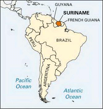
Location: Suriname is located between 2º and 6º North of the Equator. The shape of the country is almost square.The northern border is the Atlantic Ocean. The west side is bordered by the People's Republic of Guyana, and the east side by French Guiana -both countries are accessible by paved roads. Brazil is at the southern border, which runs through the mountains and hilly savannas of the Amazon region.
MAP
Climate
Temperatures average about 27° C (81° F) and the climate is usually warm and humid. Thankfully,the constant trade winds bring cooling relief. During dry seasons, the temperature may reach 36° C (96° F) at mid-day in the shade. At night, the temperature rarely drops below 24° C (75° F).
Time zone
Surinam time is two hours later than Eastern Standard Time (EST) in the USA and three hours earlier than Greenwich Mean Time (GMT) in Europe .
Phone
Country code (597) + 6 digit local number
Languages
There are different cultural groups within the country,thus they all speak their own language: obviously the Amerindians communicate in Karaib or Arowak, East-Indians speak in Sarnami Hindostani, which is based on Hindi, the Maroons talk in Aucaans or Sarramacan and the Indonesians use their native Javanese tongue.
The official language is Dutch while many people in Paramaribo speak in English, especially at the tourist spots. The government and media speak in Dutch. Dutch is taught in schools and high school students are required to learn and understand English and Spanish. This two dilects are usually their second foriegn language.