Area: approx 240 sq.km
Population: 12,271 (2008)
Capital: Avarua
Language: English and Rarotongan
Religion: Christianity, particularly Catholic and Congregational Christian Church
Time Zone: UTC - 10
Electricity: 240 Volts AC 50Hz
Passport: A valid passport required by all
Currency: New Zealand dollar
Health: Little risk of disease, just beware of sunburn and insect bites. Nevertheless, recommended vaccinations are Hepatitis A, Hepatitis B (infants and children), typhoid and rabies.
Climate: warm, June - August are cool months, November to March are wet months.
Situated in the South Pacific, the Cook Islands are spread across about 2 million square km of sea. On the east lies Tahiti and on the west lies America Samoa. It is just over 3000km away from Auckland New Zealand .
Looking for a magical South Pacific fantasy vacation? Consider the Cook Islands ! With its golden sandy beaches, mild tropical climate, warm friendly people and favorable exchange rate, it is a natural choice for travelers considering a warm weather destination.
Located three hours flight time south of Hawaii , accommodations for this group of islands include small intimate inns, private villas, as well as larger resorts. Many places offer complimentary breakfast and water sports gear. Diving is top notch with excellent visibility and an abundance of dive sights including drop-offs, canyons, wrecks and caves. Hikes and reef walking are great alternatives for land lovers. Cycling is another option with bicycle rentals at many other locations. Raratonga, the main island, offers some of the most diverse dining options in the South Pacific with over 20 restaurants.
A visit to the Cook Islands is not complete without an excursion to the beautiful island of Aitutaki . You may opt for a day tour including a scenic lagoon cruise with a sumptuous barbecue lunch or better yet, plan to stay several nights in the picturesque and romantic hideaway.
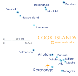
Cook Islands Map